61 MCDONALD ST
Owner Information
VILLA MACHINE ASSOCIATES INC
61 MCDONALD ST
DEDHAM, MA 02026


Property Details
61 MCDONALD ST is classified as a Buildings for manufacturing operations (Warehouse).
The primary structure on this property was built in 1930. There are 8404ft2 of built area within this property. There is 8404ft2 of residential/living space within this property.
61 MCDONALD ST is valued at 602200. The land is valued at 266500 and the structures are valued at 335700.
This property is in Zone LM. Confirm with local Zoning Board authorities to ensure there are no overlays or other easements on this property.
The most recent deed for 61 MCDONALD ST is recorded at the local registrar in Book 533, Page 67. 61 MCDONALD ST was last sold on 1978-05-12 for 0.
Assessment data from fiscal year 2020.
Flood Data
According to the FEMA National Flood Hazard Layer, this property does not appear to be in a flood zone. It may also be in an area not yet reviewed. Nonetheless, confirm this information prior to taking any action.
To view the flood hazards around this property, create a FEMA "Firmette" Map of the area around 61 MCDONALD ST.
Broadband Internet Providers
| Provider | Type | Bandwidth (mbps) | |
|---|---|---|---|
| Crown Castle Fiber | Fiber | 0 | 0 |
| VSAT Systems, LLC. | Satellite | 2 | 1 |
| HughesNet | Satellite | 25 | 3 |
| GCI Communication Corp. | Satellite | 0 | 0 |
| RCN | Cable | 1000 | 20 |
| RCN | Cable | 500 | 20 |
| Comcast | Cable | 1000 | 35 |
| Verizon New England Inc. | Fiber | 940 | 880 |
| Verizon New England Inc. | DSL | 1 | 0 |
| Viasat Inc | Satellite | 100 | 3 |
Broadband service provider data from December 2020.
Adjacent Properties
- 66 LANCASTER RD
Single Family Residential owned by 49 ARLINGTON ROAD LLC - 59 MCDONALD ST
Buildings for manufacturing operations owned by KAMPERSAL INC - 74 LANCASTER RD
Single Family Residential owned by PAPADINIS NICHOLAS S ETUX - 76 LANCASTER RD
Single Family Residential owned by KING CHRISTINE - 70 LANCASTER RD
Single Family Residential owned by LEAHY MICHAEL G. ETAL - 78 MCDONALD ST
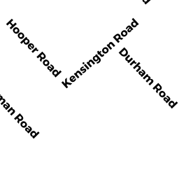
Vacant, Transportation Authority owned by MASSACHUSETTS BAY - 104 HOOPER RD 104
Condo NL MDL-05 owned by PANKIEVICH CHRISTINA - 106 HOOPER RD 106
Condo NL MDL-05 owned by TRETHEWEY ERIN M - 108 HOOPER RD 108
Condo NL MDL-05 owned by GONSKI DEBORAH L - 84 DURHAM RD 84
Condo NL MDL-05 owned by DRISCOLL MELVINA A - 86 DURHAM RD 86
Condo NL MDL-05 owned by FRANCIS ANNE - 88 DURHAM RD 88
Condo NL MDL-05 owned by LYONS THOMAS C ETUX - 84 LANCASTER RD 84
Condo NL MDL-05 owned by JEANINE MCCARTAN REV TR THE - 99 DURHAM RD 99
Condo NL MDL-05 owned by GHANTOUS SHARON - 103 DURHAM RD 103
Condo NL MDL-05 owned by ZAKUTA VLADIMIR ETUX - 85 LANCASTER RD 85
Condo NL MDL-05 owned by GILLON PAULINE T - 86 LANCASTER RD 86
Condo NL MDL-05 owned by O'SULLIVAN JOHN BARRY - 87 LANCASTER RD 87
Condo NL MDL-05 owned by SMB FAMILY RLTY TRUST - 89 LANCASTER RD 89
Condo NL MDL-05 owned by SULLIVAN RICHARD H - 28 LEOMINSTER RD 28
Condo NL MDL-05 owned by MAZENKOFSKI DITA ETAL - 83 LANCASTER RD 83
Condo NL MDL-05 owned by HESSON JILL L - 89 DURHAM RD 89
Condo NL MDL-05 owned by SZYMANSKA NATALIA A - 90 DURHAM RD 90
Condo NL MDL-05 owned by DEWIRE MILDRED D - 91 DURHAM RD 91
Condo NL MDL-05 owned by LEARNED NICOLE M - 92 DURHAM RD 92
Condo NL MDL-05 owned by BISHAY NAGWA - 93 DURHAM RD 93
Condo NL MDL-05 owned by GILLEECE ANDREW ETUX - 94 DURHAM RD 94
Condo NL MDL-05 owned by JARVIS BARBARA A - 96 DURHAM RD 96
Condo NL MDL-05 owned by GALVIN PAUL E ETUX - 97 DURHAM RD 97
Condo NL MDL-05 owned by LYNSKEY SANDRA M - 98 DURHAM RD 98
Condo NL MDL-05 owned by DEPAOLI, CHRISTOPHER R. - 28-45 DURHAM ROAD
Other, Open Space owned by None - 30 LEOMINSTER RD 30
Condo NL MDL-05 owned by SAVOV PETKO V ETAL - 32 LEOMINSTER RD 32
Condo NL MDL-05 owned by STENTIFORD DEBORAH - 34 LEOMINSTER RD 34
Condo NL MDL-05 owned by MARTIN JAMES A JR - 36 LEOMINSTER RD 36
Condo NL MDL-05 owned by SLAVIN ALLEN J ETUX - 38 LEOMINSTER RD 38
Condo NL MDL-05 owned by PURCELL MAX ETAL - 39 LEOMINSTER RD 39
Condo NL MDL-05 owned by DOWNS ROBERT F JR ETUX - 40 LEOMINSTER RD 40
Condo NL MDL-05 owned by SHIELDS MARGARET M - 41 LEOMINSTER RD 41
Condo NL MDL-05 owned by FRASER RICHARD P ETUX - 43 LEOMINSTER RD 43
Condo NL MDL-05 owned by ENGLISH NANCY J - 80 LANCASTER RD 80
Condo NL MDL-05 owned by MCQUAID MARGARET V - 45 LEOMINSTER RD 45
Condo NL MDL-05 owned by CORRIGAN DEBRA J - 80 HOOPER RD 80
Condo NL MDL-05 owned by BODNER VADIM - 82 HOOPER RD 82
Condo NL MDL-05 owned by RAHILLY THOMAS J ETUX - 84 HOOPER RD 84
Condo NL MDL-05 owned by ADAMS, STEVEN - 86 HOOPER RD 86
Condo NL MDL-05 owned by DUFFY MARY ETAL - 88 HOOPER RD 88
Condo NL MDL-05 owned by RAHILLY KOLLEEN P - 90 HOOPER RD 90
Condo NL MDL-05 owned by LODI LAWRENCE M ETAL - 94 HOOPER RD 94
Condo NL MDL-05 owned by NAYMIE KAREN M - 96 HOOPER RD 96
Condo NL MDL-05 owned by BISHAY NAGY F - 82 LANCASTER RD 82
Condo NL MDL-05 owned by GIORDANO ARLENE - 98 HOOPER RD 98
Condo NL MDL-05 owned by LEE TERESA A - 100 HOOPER RD 100
Condo NL MDL-05 owned by O'LEARY MARY P - 102 HOOPER RD 102
Condo NL MDL-05 owned by DAVIS ERICA L - 95 DURHAM RD 95
Condo NL MDL-05 owned by AIST PAMELA - 37 LEOMINSTER RD 37
Condo NL MDL-05 owned by CRIMLISK JANE T - 92 HOOPER RD 92
Condo NL MDL-05 owned by BRUNO DIFAZIO TRUST - 110 HOOPER RD 110
Condo NL MDL-05 owned by MUTTER HANNAH R - 101 DURHAM RD 101
Condo NL MDL-05 owned by LOPEZ MILENA ETAL